Home · Catalogue · History & Americana · S.I.6449
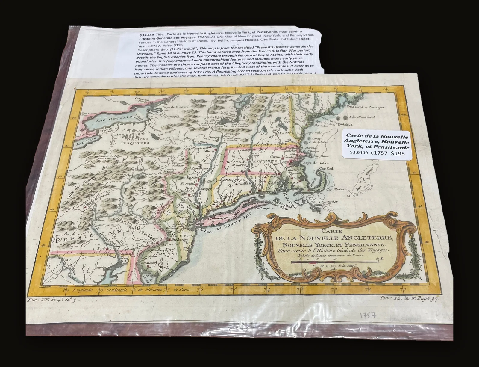
Carte de la Nouvelle Angleterre, Nouvelle York, et Pensilvanie. Pour servir a l'Histoire Generale des Voyages. TRANSLATION: Map of New England, New York, and Pennsylvania. For use in the General History of Travel.
Bellin, Jacques Nicolas · Paris
- Author
- Bellin, Jacques Nicolas
- Date
- c1757
- Place
- Paris
- Publisher
- Didot
- Language
- English
- Binding
- 8vo. (11.75" x 8.25") This map is from the set titled "Prevost's Histoire Generale des Voyages," Tome 14 in 8. Page 23. This hand-colored map from the French & Indian War period, details the English colonies from Pennsylvania through Penobscot Bay in Maine, with their early boundaries. It is fully engraved with topographical features and includes many early place names. The colonies are shown confined east of the Allegheny Mountains with the Nations Iroquoises, Indian villages, and several French forts located west of the mountains. It extends to show Lake Ontario and most of Lake Erie. A flourishing French rococo-style cartouche with distance scale decorates the map.References: McCorkle #757.1; Sellers & Van Ee #721
- Category
- History & Americana
- Record
- S.I.6449
Carte de la Nouvelle Angleterre, Nouvelle York, et Pensilvanie. Pour servir a l'Histoire Generale des Voyages. TRANSLATION: Map of New England, New York, and Pennsylvania. For use in the General History of Travel.
Author: Bellin, Jacques Nicolas
8vo. (11.75" x 8.25") c1757. Bellin, Jacques Nicolas. Paris. Didot. This map is from the set titled "Prevost's Histoire Generale des Voyages," Tome 14 in 8. Page 23. This hand-colored map from the French & Indian War period, details the English colonies from Pennsylvania through Penobscot Bay in Maine, with their early boundaries. It is fully engraved with topographical features and includes many early place names. The colonies are shown confined east of the Allegheny Mountains with the Nations Iroquoises, Indian villages, and several French forts located west of the mountains. It extends to show Lake Ontario and most of Lake Erie. A flourishing French rococo-style cartouche with distance scale decorates the map.References: McCorkle #757.1; Sellers & Van Ee #721
We are currently putting all 5000+ titles online, but if there is a specific title you are looking for, please reach out to sidekerbookselleratgmail.com, we may just have it!
Free shipping via USPS for United State purchaser within the continental U.S., International shipping determined using USPS Priority Express, DHL, FedEx, or Parcel Monkey.
Sonny Ideker Bookseller is located within City Antiques in Historic Roswell, Georgia at 700 Holcomb Bridge Road, Roswell, GA. 30076. We would love to have you visit or email us at sidekerbookseller at gmail.com for specific wants or needs, thanks!
Find Us On: Facebook: https://www.facebook.com/p/Sonny-Ideker-Bookseller-Rare-Antiquarian-Leather-Vellum-Bound-Books-100068669041560/ YouTube: https://www.youtube.com/@SonnyIdekerBookseller/about Instagram: https://www.instagram.com/sonny_ideker_bookseller Flickr: https://flic.kr/ps/2v6pn4 Website: https://sonnyideker.weebly.com/ Antique Books, Old Leather Book, Old Vellum Book, Decorative Binding, Antiquarian Book, Vintage decorative, Ancient Leather, Rare Books, Decorative Books, Decorative Leather, Beautiful Decorative Books
Condition
Very Good
Guaranteed authentic and as described · 7-day returns · free US shipping — our terms. Subject to prior sale.